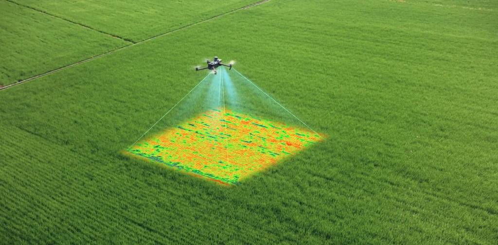
Resource management is critical for the agriculture business to maintain economically feasible practices. Hextronics drone deployment systems allow for remote monitoring, high quality imaging, and heat mapping for analyzation, to improve irrigation and efficiency.
Soil Analyzation
Ground Heat Mapping
Growth Monitoring
HD Land Imaging
Topography Surveying
Livestock Tracking


BENEFITS

Growth Predictions
Evaluate growth and estimate production height from gathering data in 3D imaging software.

Heat Mapping
Investigate topography, ground temperature, and irrigation efficiency to make more educated decisions for higher production.

Efficiency
Rapid drone deployment mitigates the time and expense necessary when fields require inspection and analyzation.